Ancient Lake Bonneville, which at its peak was nearly as large as Lake Michigan, spread across much of western Utah and parts of Nevada and Idaho during the Ice Age. The lake began forming about 55,000 years ago during a cool, wet period when volcanic eruptions in southeastern Idaho diverted the Bear River, causing water to gather in Gem Valley and other basins to the south.
About 18,000 years ago, water breached a natural dam at Red Rock Pass, unleashing a torrent into the Columbia River system. Over a six-week period, lake levels plummeted by more than 350 feet as one of North America's largest floods occurred. As the climate warmed and dried in subsequent millennia, the lake shrank dramatically, leaving remnants that include the Great Salt Lake, Utah Lake, and Sevier Lake.
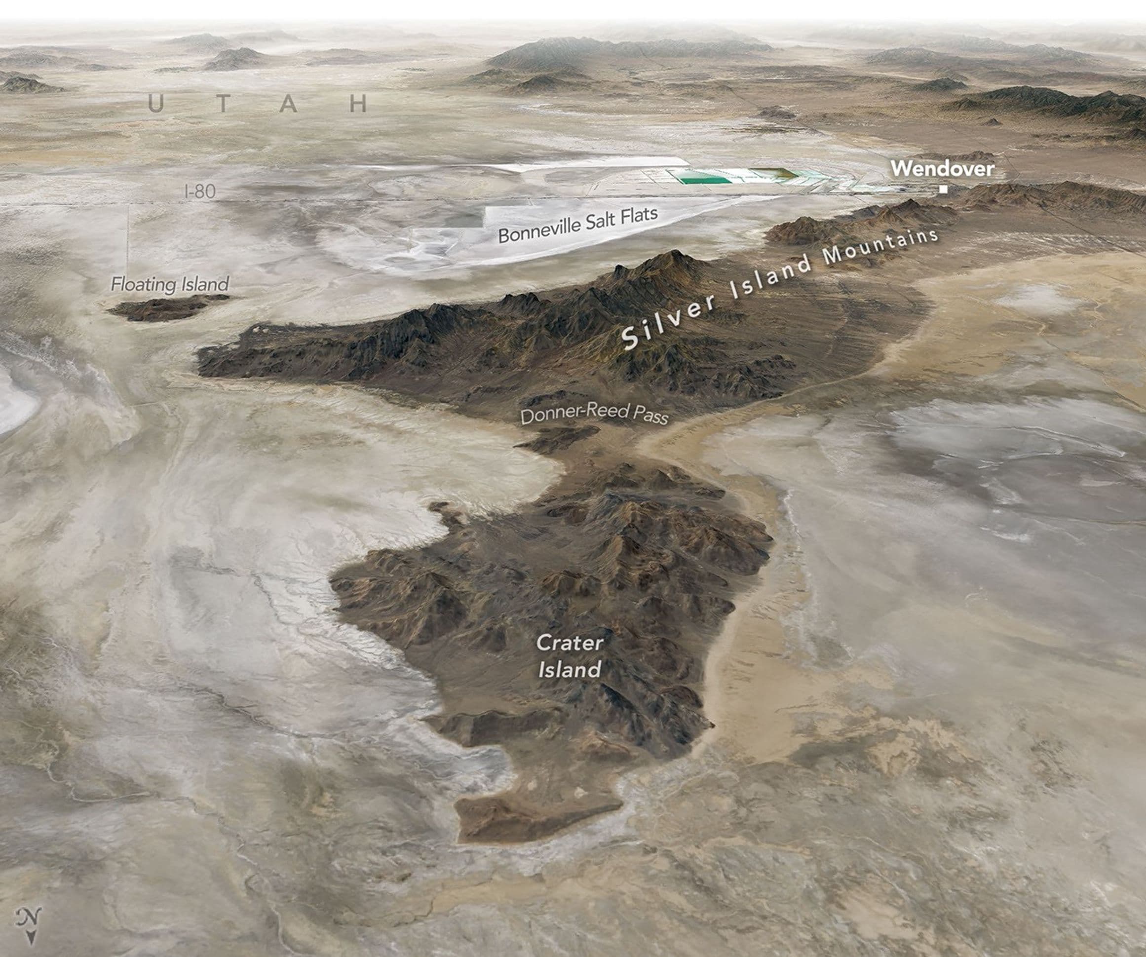
Satellite imagery captured by the Operational Land Imager on the NASA-USGS Landsat 8 satellite shows the lake's imprint on the landscape. The dried lakebed appears pale compared to darker, rockier, more vegetated surroundings, while bathtub-like rings and wave-cut terraces trace former shorelines. Bright deposits of evaporite minerals coat land surfaces in deep parts of the basin where runoff and groundwater still pool, forming salt flats typically containing halite, gypsum, and potassium- and magnesium-bearing salts.
In June 2026, NASA scientists and engineers working with the agency's DAVINCI mission came to Crater Island to field-test cameras and instruments designed for Venus exploration. During rehearsals, the camera system took hundreds of images of rock formations while suspended from a helicopter, allowing the team to create three-dimensional maps consistent with existing geologic maps. The scientists said they expect to use this capability to map geology on Venus in an area called Alpha Regio.
Lake Bonneville's playas have also hosted notable human achievements. In 1960, Mickey Thompson became the first American to break the 400-miles-per-hour barrier, reaching 406.60 miles per hour on the Bonneville Salt Flats. More recently, in August 2026, Andy Green set a record for the fastest land speed in a hydrogen-fueled internal-combustion vehicle, reaching 406.320 miles per hour. Nearly two centuries earlier, members of the ill-fated Donner-Reed Party passed along the southern edge of Crater Island in August 1846, with their heavy wagons breaking through the thin salt crust and becoming mired in underlying mud.