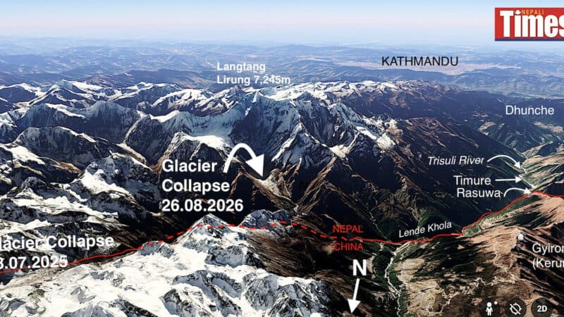
A 4.4 magnitude earthquake struck near the Nepal-China border on August 26 at 8:37 a.m. Nepal Time, triggering a massive avalanche on the north face of Mount Langtang Lirung, which towers 7,245 meters above sea level 45 kilometers north of Kathmandu. The avalanche blocked the monsoon-swollen Lhende Khola river, which marks the border between the two countries, creating an impounded lake that burst soon after.
The rupture sent a wall of mud, water, and boulders racing down the Trisuli River into Nepal, according to experts who analyzed satellite images from Planet Labs. Scientists remain divided on whether the earthquake triggered the slope collapse or whether the avalanche itself caused the seismic event. The tremor struck a mountain where snow and ice were already unstable due to global warming, on slopes heavy with precipitation during the monsoon season and where permafrost-bound moraines left by glacial retreat were saturated with water.
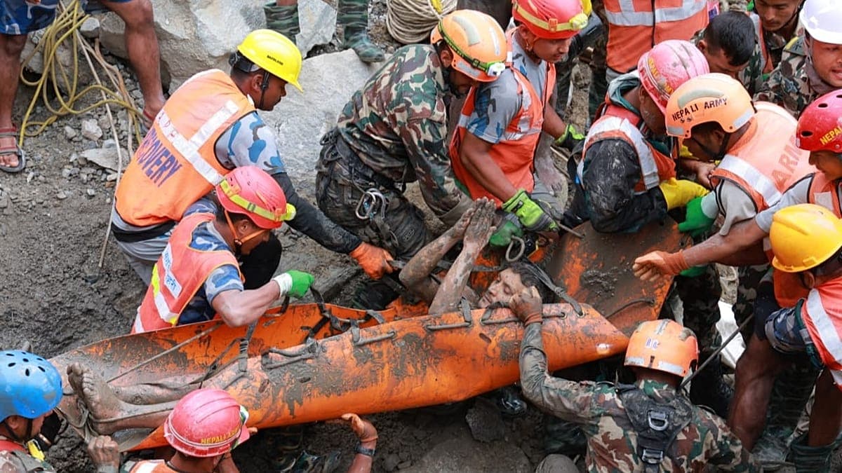
By August 27, the official death toll had climbed past 160 and was expected to reach hundreds. Human bodies, animal carcasses, and debris were seen floating down the Narayani River 200 kilometers downstream in Nawalparasi district. At least six major hydropower plants, transmission lines, and electrical substations on the Bhote Kosi and Trisuli rivers were either destroyed or heavily damaged, and at least a dozen bridges across the two rivers were swept away, cutting off highways leading north.
The disaster comes amid an increasing pattern of transboundary glacial hazards. Experts noted similar recent events including floods in Chamoli, Melamchi, Sikkim, Thame, and Bhote Kosi, most occurring during monsoon season. Last year's Rasuwagadhi flood in July killed 18 people and destroyed the Nepal-China border checkpoint for trade and tourism, though the Chinese side had reportedly warned local Nepali authorities of the danger. This year there was no warning despite the avalanche and flood's origin being much closer to the border.
Prime Minister Balendra Shah's government, which came to power less than six months ago following elections in late 2025, now faces immediate search and rescue operations and widespread rehabilitation along the ravaged Trisuli Valley. Infrastructure losses are expected to reach billions of dollars, raising questions about Nepal's response to climate change and seismic hazards expected to increase in the future.