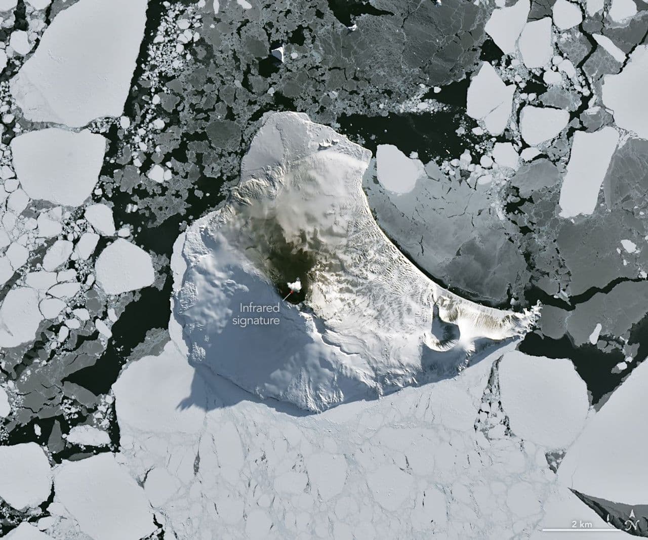
A rare cloud-free satellite image captured Mount Michael's ongoing volcanic activity as winter began to release its grip on the remote Antarctic region. The Operational Land Imager on the NASA-USGS Landsat 8 satellite acquired the natural-color image on August 24, 2026, revealing heat from a persistent lava lake in the stratovolcano's summit crater through infrared signals shown in red. A volcanic plume hovering over the peak and darkened snow on the northern slopes also indicated ongoing activity.
Mount Michael rises above the ice-filled South Atlantic Ocean at the center of Saunders Island, part of the South Sandwich Islands, a chain of small volcanic peaks about 350 kilometers long formed by the South American plate subducting beneath the tiny South Sandwich plate. Regular eruptions, including at Mount Michael, have occurred on these islands in recent centuries.
Because of the volcanoes' remoteness, scientists rely on satellite data to monitor their activity. Analysis of thermal anomalies in observations from Landsat, Sentinel, and ASTER instruments spanning 30 years led researchers to conclude that Mount Michael hosts a persistent lava lake in its summit crater. Only a handful of other volcanoes on Earth, including Kīlauea, Nyamulagira, and Erta Ale, are known to have similar, frequently active features.
Data from the MODIS and VIIRS instruments have enabled long-term monitoring of Mount Michael, with information provided through MIROVA, a near-real-time volcanic hot spot detection system, indicating that low-intensity activity has been ongoing for the past several years. Observations from NASA's Aura satellite show that emissions of sulfur dioxide and other gases are common at Mount Michael.
The clear weather window over Mount Michael closed within a week. When Landsat 9 passed over the island, a more active atmosphere had returned and weather patterns interacted with the peak to produce wave clouds resembling a ship's wake. False-color imagery from NASA's Aqua satellite indicated that a volcanic track caused by degassing sulfur dioxide was likely present as well.
